What is the Geographical Location of the Eastern Anatolia Fault?
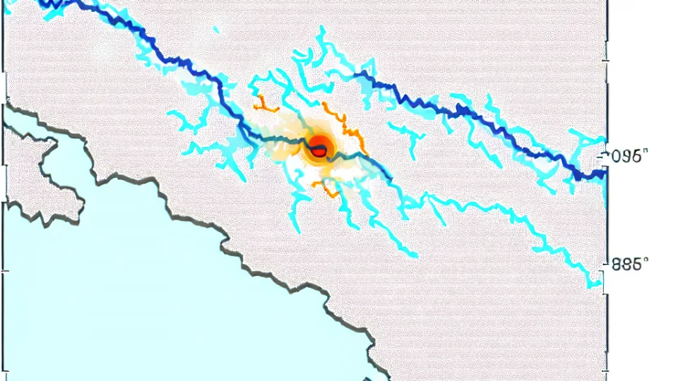
The Eastern Anatolia Fault is an important fault line located in the east of Turkey. This fault extends through the Eastern Anatolia Region of Turkey, starting from Adıyaman and passing through the borders of Malatya, Elazığ, and Tunceli provinces, continuing all the way to Erzincan. The total length of the fault is approximately 700 km, making it one of the longest fault lines in Turkey. Additionally, this fault line is notable for its east-west orientation.
The geographical location of the Eastern Anatolia Fault is of great importance in determining Turkey's geological structure and active earthquake zones. While the fault passes through the rural areas of the Eastern Anatolia Region, it also affects major cities and settlements. This situation directly impacts the population density and urbanization in the region. The settlements along the fault's path become more vulnerable to earthquakes.
- Adıyaman
- Malatya
- Elazığ
- Tunceli
- Erzincan
The geographical location of the Eastern Anatolia Fault interacts not only within the borders of Turkey but also with neighboring countries. The fault line is quite close to the Iranian border located to the east of Turkey. This situation increases the seismic activity in the region and spreads the effects of earthquakes over a wider area. Therefore, the location of the Eastern Anatolia Fault holds critical geological significance for both Turkey and its neighboring countries.
In conclusion, the geographical location of the Eastern Anatolia Fault plays an important role in understanding the seismic events and earthquakes occurring in the east of Turkey. Awareness of this fault line is crucial for risk management and disaster preparedness. Furthermore, the structures to be built in the settlements affected by this fault need to be designed for earthquake resistance. Such measures are of great importance to enhance the safety of life and property in the region.
Which Cities Does the Eastern Anatolia Fault Pass Through?

The Eastern Anatolia Fault (EAF) is a significant seismic fault located in the eastern part of Turkey. This fault line passes through many cities and regions, creating areas in Turkey that are at high risk of earthquakes. Notably, cities such as Elazığ, Malatya, Adıyaman, Gaziantep, and Şanlıurfa are among the regions affected by the EAF. Earthquakes occurring in these cities raise significant concerns both locally and nationally.
The route of the EAF encompasses not only major cities but also many smaller settlements. For example, the Sivrice district of Elazığ is one of the most critical points of this fault. The earthquakes that occasionally occur here pose serious threats in terms of both the resilience of buildings and the living standards of people. Therefore, the earthquake preparedness of residential areas in the region should be continuously reviewed.
Another important transition point is Malatya. The residential areas of Malatya frequently experience tremors due to the influence of the EAF. This situation necessitates that construction and engineering practices in the region be made more robust and durable. Additionally, it is crucial for the residents of Malatya to develop earthquake awareness. Therefore, training programs and drills organized by local authorities contribute to raising public awareness on this issue.
Cities such as Gaziantep and Şanlıurfa are also affected by the EAF. Gaziantep, being a city that is particularly developed in terms of industry and commerce, would face economic repercussions from any earthquakes that may occur here. Therefore, the earthquake safety and emergency plans of the cities should be continuously updated, and the public should be informed about these matters. A comprehensive strategy needs to be developed to minimize earthquake risk in all cities through which the EAF passes.
Why is the Eastern Anatolia Fault (DAF) Important in Terms of Earthquake Risk?
The Eastern Anatolia Fault (DAF), located in the east of Turkey, is a significant fault line that carries a high earthquake risk. This fault is known as one of the most active earthquake regions in Turkey, posing a significant threat to the local population. The DAF occasionally generates major earthquakes, leading to both loss of life and property. Considering this situation, the importance of the DAF in terms of earthquake risk becomes even more evident.
The significance of the DAF in terms of earthquake risk is also related to the length of the fault line and the historical earthquake activities in the region. The DAF is approximately 600 kilometers long, and this length creates a foundation for large-scale earthquakes to occur. Additionally, the proximity of various settlements in the region to this fault line increases the impact of potential earthquakes on human life. Therefore, the DAF should be continuously monitored and necessary precautions should be taken.
- The DAF is one of the most active earthquake faults in Turkey.
- Historically, it has caused significant earthquakes.
- The location of settlements in the region increases the risk.
- It is a fault line that requires continuous monitoring.
Another important aspect of the DAF in terms of earthquake risk is its geological structure. This fault line is situated on different geological layers, and the movement of these layers causes earthquakes to occur. Therefore, understanding the geological characteristics of this fault line is critical for predicting earthquakes and mitigating their effects. Scientists are working to better assess the probabilities of future earthquakes through research conducted on the DAF.
What Are the Historical Earthquakes Observed on the Eastern Anatolia Fault (DAF)?
The earthquakes that occur on the Eastern Anatolia Fault (DAF) are among the most significant indicators of Turkey's seismic activity. Historically, this fault line has hosted many important earthquake events. Particularly in the 20th century, the major earthquakes along this fault resulted in serious consequences in terms of both loss of life and material damage. These earthquakes pose significant risks to the settlements and infrastructure in the region.
Notably, the earthquake that occurred in 1940, recorded at a magnitude of 7.0, demonstrates how active the DAF fault is. This earthquake caused extensive damage in Malatya and the surrounding provinces, and also resulted in the loss of many lives. Such major earthquakes necessitate careful monitoring of the region's earthquake risk.
The earthquake that took place in 1990, measured at a magnitude of 6.8, is another significant historical earthquake of the DAF fault. This earthquake caused widespread destruction in the settlements around Elazığ, damaging numerous buildings. This event led to increased awareness and preparedness among the local population regarding earthquakes.
Lastly, the earthquake with a magnitude of 6.5 that occurred in 2010 indicates that seismic activity on the DAF fault continues. The investigations conducted after this earthquake provided important data to better understand the dynamics of the fault line. Such historical earthquakes contribute to the development of early warning systems for potential future tremors.
What is the Formation Process of the Eastern Anatolia Fault?
The formation process of the Eastern Anatolia Fault has been shaped by the effects of tectonic movements. This fault line emerged as a result of the collision between the Anatolian Plate and the African Plate. Centuries of this mobility have led to significant changes on the Earth's surface, accelerating the formation of the fault. This process causes the release of accumulated energy underground, paving the way for earthquakes.
The geological events occurring along the fault line have created visible fault traces on the Earth's surface. These traces help us understand how active the fault is and the magnitude of past earthquakes. In particular, the various geological layers on the Eastern Anatolia Fault play a crucial role in the development of the fault. These layers reflect the environmental conditions of different periods, revealing the history of the fault.
The formation of the Eastern Anatolia Fault is related to fracture mechanisms. These mechanisms come into play with the increasing accumulation of stress in the Earth's crust. Along the fault line, this stress accumulation eventually leads to fractures at the fault's weak points. These fractures trigger major earthquakes and cause structural changes in the region. Therefore, understanding the dynamics of the fault is critical for assessing future earthquake risks.
Finally, the formation process of the Eastern Anatolia Fault is also influenced by climate changes and other natural factors. These factors can indirectly affect the fault's activity by influencing underground water movements and geological structures. Thus, the formation process of the fault is multi-layered and not limited to tectonic movements alone. Considering all these factors enables a better understanding of the fault.
What Will Be the Future Seismic Activity of the Eastern Anatolian Fault (EAF)?
The Eastern Anatolian Fault (EAF) is a significant fault line located in the eastern part of Turkey, and its future seismic activity is a major concern for both the local population and scientists. When evaluated in light of historical data and current observations, the seismic activity of this fault line provides important clues about potential future earthquakes. Scientists are conducting various modeling efforts to understand the dynamics of the EAF. These models aim to make predictions about the future behaviors of the fault line and the magnitudes of possible earthquakes.
One of the factors influencing future seismic activity is the past movements of the fault line. Major earthquakes that have occurred along the EAF indicate the directions in which the fault has moved and which areas are at greater risk. Additionally, the geological structures surrounding the fault line can also affect seismic activity. For example, volcanic activities in the region and groundwater levels are among the factors that influence the magnitude and frequency of earthquakes. Therefore, all geological factors in the region need to be taken into account.
- Past major earthquakes of the fault line
- Geological structures and volcanic activities in the region
- Groundwater levels and their effects on earthquakes
- Seismic modeling and prediction methods
Finally, various scenarios are being proposed regarding how the seismic activities occurring along the EAF will unfold in the future. These scenarios are important for ensuring that both local authorities and the public are prepared. In particular, improvements in disaster management strategies and the earthquake safety of structures will enhance the capacity to cope with future seismic activities. In this context, the development of seismic risk analysis and early warning systems is critical for potential earthquakes along the EAF.
What You Need to Know About the Eastern Anatolia Fault
The Eastern Anatolia Fault is one of Turkey's most significant seismic faults and is located in the eastern part of Turkey. This fault line has a length of 600 km, extending in an east-west direction. The fault is known to be a structure formed as a result of the friction between two separate tectonic plates. Therefore, the Eastern Anatolia Fault represents an area frequently associated with earthquakes, where the intensity of these earthquakes can be high.
Among the general characteristics of the fault line are high energy accumulation and the sudden release of this energy. The earthquakes resulting from this release pose serious threats to the settlements in the region. Additionally, the residents living around the Eastern Anatolia Fault must be prepared for these earthquakes. For this reason, research on the characteristics of the fault and its potential impacts is extremely important.
- Cities along the fault line: Elazığ, Malatya, Gaziantep
- Earthquakes on the fault typically have magnitudes of 6.0 and above
When examining the historical earthquakes of the Eastern Anatolia Fault, it is clear how active this seismic area is. The major earthquakes experienced in the past raise questions about the resilience of the structures in the region. Furthermore, the loss of life and property during these earthquakes necessitates that the local population increases their preparedness for earthquakes. In conclusion, being informed about the Eastern Anatolia Fault is vital for minimizing the risks in this region.