What Are the Geological Features of Kagoshima?
Kagoshima, located on the southern tip of Kyushu Island in Japan, is renowned for its unique geological features that contribute to its seismic activity. The region is characterized by its proximity to tectonic plate boundaries, particularly the interaction between the Philippine Sea Plate and the Eurasian Plate. This interaction is responsible for the high frequency of earthquakes and volcanic eruptions in the area. Additionally, the presence of active volcanic systems, particularly Sakurajima, plays a significant role in the geological dynamics of Kagoshima, making it a hotspot for geological studies.
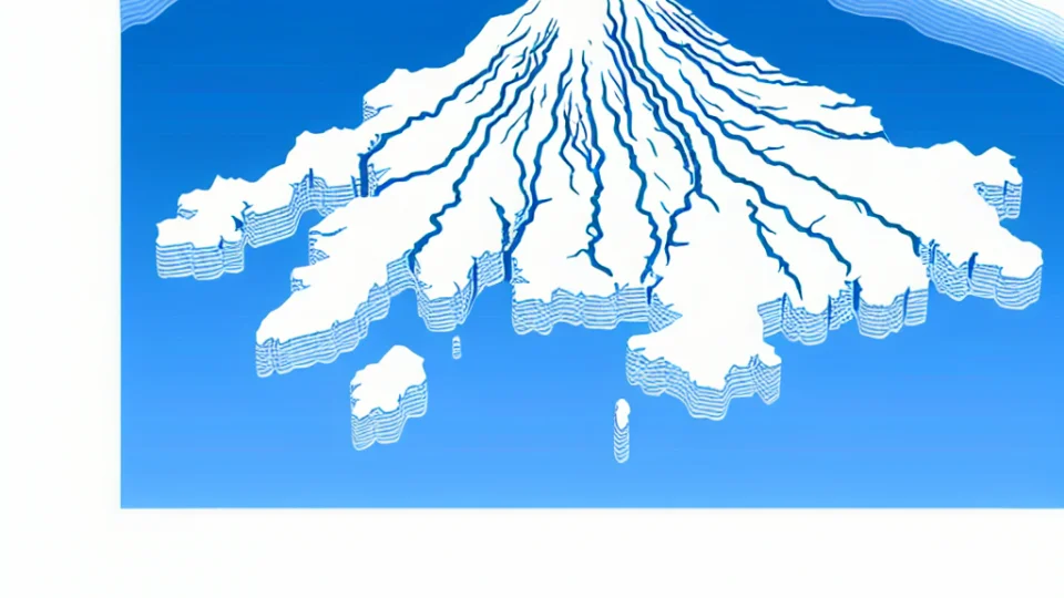
The topography of Kagoshima also influences its seismic characteristics. The region features a combination of mountainous terrain and coastal plains, which can amplify seismic waves during an earthquake. The geological composition of the area includes volcanic rock formations and sedimentary layers, which can affect how seismic waves travel through the ground. Understanding these geological aspects is crucial for predicting earthquake behavior and assessing potential risks for the local population.
In addition to tectonic activity, the hydrothermal systems in Kagoshima contribute to its geological complexity. Hot springs and geothermal phenomena indicate active geological processes beneath the surface. These features are not only significant for understanding the region's geology but also provide opportunities for geothermal energy production. The interplay between these hydrothermal systems and tectonic movements can lead to increased seismicity, further highlighting the dynamic nature of Kagoshima’s geology.
Lastly, the historical seismic records of Kagoshima provide valuable insights into its geological past. Analyzing past earthquakes and their magnitudes allows scientists to create models that predict future seismic events. This historical perspective is essential for developing effective disaster preparedness strategies in the region. By understanding the geological features of Kagoshima, residents and authorities can better equip themselves to handle the challenges posed by frequent seismic activity.
How Do Tectonic Plates Affect Kagoshima's Seismic Activity?

Kagoshima is situated in a region where the Philippine Sea Plate and the Eurasian Plate converge, creating a complex tectonic environment. This convergence results in significant seismic activity as the plates interact with one another. When these tectonic plates collide, they generate stress that eventually leads to the release of energy in the form of earthquakes. The movement of these plates is not uniform, and this irregularity contributes to the frequent seismic events experienced in Kagoshima. Understanding this tectonic interaction is essential for grasping the underlying reasons for the area's high earthquake frequency.
The subduction of the Philippine Sea Plate beneath the Eurasian Plate is a key factor influencing Kagoshima's seismic landscape. As the oceanic plate descends into the mantle, it melts and causes magma to rise, which can lead to volcanic activity as well as earthquakes. This subduction zone creates a dynamic environment where both volcanic eruptions and tectonic earthquakes can occur, often in quick succession. The interplay between volcanic and seismic activity in this region makes it a unique geological hotspot that attracts both researchers and those interested in understanding earthquake mechanisms.
Additionally, the tectonic setting of Kagoshima is characterized by numerous fault lines, which are fractures in the Earth's crust where movement has occurred. These faults can accumulate stress over time, leading to sudden releases of energy in the form of earthquakes. The presence of these faults indicates that the region is highly active, and monitoring them is crucial for earthquake prediction and risk mitigation. The complexity of the fault systems in this area contributes to the unpredictability of seismic events, making Kagoshima a focal point for geologists and seismologists studying earthquake patterns.
Finally, the seismic activity in Kagoshima is not solely attributed to tectonic plate interactions. Other geological factors, such as the presence of volcanic systems and local geological structures, also play significant roles in influencing the frequency and intensity of earthquakes. The region's geological history, marked by various volcanic eruptions and tectonic shifts, has shaped its current seismic profile. Continuous research and monitoring of these tectonic dynamics are vital for enhancing our understanding of earthquake risks and improving safety measures for the residents of Kagoshima.
What Historical Earthquakes Have Occurred in Kagoshima?
Kagoshima, Japan, is no stranger to seismic activity, and its historical records demonstrate a pattern of significant earthquakes. One of the most notable events was the 1896 Sanriku Earthquake, which had a magnitude of 8.5. Although this earthquake was centered off the Sanriku coast, it had far-reaching effects, including tsunami waves that impacted the Kagoshima area. This event serves as a reminder of how interconnected seismic activity can be across regions, emphasizing the need for robust monitoring systems.
Another historical earthquake that shook Kagoshima was the 1946 Nankai Earthquake, which reached a magnitude of 8.1. This earthquake occurred along the Nankai Trough and caused extensive damage in several areas, including Kagoshima. The aftermath of this earthquake highlighted the vulnerability of urban infrastructure in seismic zones and led to improvements in building codes and emergency preparedness in the region. Understanding these historical events is critical for improving future resilience.
The 2003 Kagoshima Earthquake, with a magnitude of 6.0, also deserves mention. This earthquake occurred near the Kirishima volcanic region and was felt strongly by residents. The event sparked discussions about the relationship between volcanic activity and seismic events in Kagoshima, illustrating how the area's geological features contribute to its seismic profile. It serves as a reminder of the need for ongoing research into the interactions between tectonic and volcanic activity in the region.
In addition to these significant earthquakes, Kagoshima has experienced numerous smaller tremors that often go unreported. These minor quakes, while not causing major damage, are essential for scientists to study. They provide valuable data on the seismic behavior of the region and help improve predictive models. Keeping track of these historical earthquakes allows researchers and authorities to develop better preparedness strategies, ultimately safeguarding the lives and properties of Kagoshima's residents.
How Do Local Communities Prepare for Earthquakes in Kagoshima?
In Kagoshima, local communities have developed a range of strategies to effectively prepare for the frequent seismic activity in the region. These preparations often begin with community education programs that provide residents with essential knowledge about earthquake risks and safety measures. Regular workshops and seminars are organized, where experts share valuable information on how to respond during an earthquake. This proactive approach not only increases awareness but also fosters a culture of preparedness among residents, ensuring that they are ready to act swiftly when a tremor occurs.
Another critical aspect of earthquake preparedness in Kagoshima is the establishment of emergency response teams that consist of local volunteers. These teams undergo rigorous training to handle various emergency scenarios, including search and rescue operations and first aid. They play a vital role in coordinating community responses during an earthquake, ensuring that help reaches those in need swiftly. Furthermore, these teams often collaborate with local government agencies and disaster management organizations to enhance their readiness and effectiveness in crisis situations.
Kagoshima's local governments also invest in infrastructure improvements aimed at minimizing earthquake damage. This includes retrofitting older buildings to meet modern seismic standards and ensuring that critical facilities like hospitals, schools, and emergency shelters are built with earthquake-resilient designs. Additionally, community drills are regularly conducted to test the effectiveness of these measures, allowing residents to practice evacuation procedures and familiarize themselves with emergency routes. This hands-on approach reinforces the importance of preparedness and builds community resilience.
Finally, communication plays a crucial role in earthquake preparedness in Kagoshima. Local authorities utilize various platforms to disseminate real-time information regarding seismic activity and safety updates. Social media, community bulletin boards, and mobile apps are employed to ensure that residents receive timely alerts about potential earthquakes. This continuous flow of information is essential for ensuring that communities remain vigilant and can respond appropriately when an earthquake strikes, thereby enhancing overall safety and preparedness.
What Are the Safety Measures for Earthquakes in Kagoshima?
In Kagoshima, a region prone to seismic activity, earthquake safety measures are critically important for protecting lives and property. Local authorities emphasize the importance of preparedness through various initiatives. Educational programs aimed at teaching residents about earthquake risks and safety protocols are regularly conducted. These programs cover essential topics such as evacuation routes, safe zones, and how to respond during an earthquake. By fostering awareness, Kagoshima's residents are better equipped to handle seismic events effectively.
One of the key components of earthquake preparedness in Kagoshima is the establishment of emergency response plans. Local governments collaborate with disaster management agencies to create detailed action plans that outline steps to be taken before, during, and after an earthquake. These plans include the identification of evacuation centers, communication strategies, and resources for assistance. Regular drills are held to ensure that the community is familiar with these procedures and can act swiftly in the event of an earthquake.
Kagoshima also invests in infrastructure resilience to withstand seismic shocks. Buildings and bridges are designed according to strict seismic codes that require them to be earthquake-resistant. Retrofitting older structures is another priority, ensuring that even the most vulnerable buildings can resist significant tremors. The local government works alongside engineering experts to assess and modify existing infrastructures, which plays a vital role in minimizing damage and enhancing public safety during an earthquake.
Community involvement is pivotal in enhancing earthquake safety in Kagoshima. Local organizations often hold workshops and training sessions focusing on first aid and emergency response skills. Residents are encouraged to create personal emergency kits, which include essential supplies such as water, food, and medical items. By promoting a culture of preparedness, Kagoshima not only increases its resilience but also fosters a sense of community solidarity, which can be invaluable during a disaster.
How Does Kagoshima's Location Contribute to Earthquake Frequency?
Kagoshima's geographical positioning plays a crucial role in its seismic activity. Located at the southern tip of Japan's Kyushu Island, Kagoshima sits near the convergence of several tectonic plates, including the Philippine Sea Plate and the Eurasian Plate. This unique location exposes the region to significant tectonic stress, which is a primary driver of earthquakes. When these plates interact, they can create faults that release energy in the form of seismic waves, leading to frequent earthquakes. The interaction between these plates is not only a cause of earthquakes but also contributes to the region's volcanic activity, further increasing seismic risks.
The topography surrounding Kagoshima also amplifies its susceptibility to earthquakes. The presence of volcanic mountains, such as Sakurajima, adds another layer of complexity to the seismic landscape. Volcanic activity often correlates with tectonic movements, resulting in additional seismic events. The region's mountainous terrain can lead to localized shaking that may be felt more intensely in certain areas. This combination of geological features and active tectonics creates a perfect storm for earthquake occurrences, making Kagoshima one of the most earthquake-prone areas in Japan.
In addition to tectonic and volcanic factors, the historical context of Kagoshima’s seismic activity cannot be overlooked. The region has a long history of significant earthquakes, which provides evidence of the ongoing geological processes at play. Understanding this historical context is vital for predicting future seismic events. Earthquakes in Kagoshima can vary in magnitude, but the frequency of smaller tremors serves as a reminder of the constant geological activity beneath the surface. These historical patterns highlight the need for continuous monitoring and preparedness in the region.
Lastly, the implications of Kagoshima's geological positioning extend beyond just the frequency of earthquakes. The continuous seismic activity has profound effects on local infrastructure and community safety. Buildings, roads, and bridges must be constructed with earthquake resilience in mind, reflecting the need for robust engineering practices. Furthermore, the awareness of seismic risks in Kagoshima has led to enhanced emergency preparedness measures among residents and local authorities. This proactive approach is essential in mitigating the impact of earthquakes and ensuring the safety of the community.
What Resources Are Available for Monitoring Earthquakes in Kagoshima?
In Kagoshima, a variety of resources are available for monitoring earthquakes, ensuring that both residents and authorities can stay informed about seismic activity. One of the primary resources is the Japan Meteorological Agency (JMA), which provides real-time data on earthquake occurrences, magnitudes, and locations. Their website features an interactive map that displays recent seismic events, allowing users to visualize the activity in the region. This resource is crucial for understanding the frequency and intensity of earthquakes, especially in a seismically active area like Kagoshima.
In addition to the JMA, local universities such as Kagoshima University conduct research on seismic activity, offering valuable insights into the geological factors that contribute to earthquakes. These institutions often collaborate with governmental bodies to improve monitoring technologies and enhance data collection methods. They publish findings that can help communities understand their risk levels and prepare accordingly. This academic contribution is essential for developing effective mitigation strategies, especially in a region prone to frequent seismic events.
Another significant resource is the use of advanced seismic sensors that are strategically placed throughout the Kagoshima region. These sensors continuously monitor ground movements and provide real-time data that is essential for early warning systems. The information collected by these sensors is vital for understanding the dynamics of earthquakes and can help predict potential aftershocks. This technological advancement enables timely alerts that can save lives and reduce property damage, making it an invaluable resource for residents.
Lastly, various mobile applications and online platforms have emerged, providing users with immediate access to earthquake data. These applications often offer features like real-time alerts and educational resources on earthquake preparedness. By utilizing these modern tools, residents of Kagoshima can stay informed and take proactive measures to protect themselves during seismic events. The combination of traditional monitoring methods and innovative technology ensures that the community is well-equipped to respond to earthquakes effectively.