Where Are the Most Active Fault Lines?

Earthquakes around the world tend to concentrate along certain fault lines. These fault lines are regions formed by the movements of tectonic plates in the Earth's crust, which can lead to significant earthquakes. For example, the San Andreas Fault, located in California, is a highly active fault. This fault can produce hundreds of small earthquakes each year, serving as a precursor to larger quakes. The length of the fault is approximately 1,300 kilometers, and a large portion of the settlements in this area are at risk.
Another significant fault line is known as the North Anatolian Fault. This fault, which runs through northern Turkey, is one of the most dangerous fault lines in the country. Particularly, the settlements in and around Istanbul are under the influence of this fault. Considering the major earthquakes that have occurred in the past along the North Anatolian Fault, it becomes clear how high the risk is in this region. Experts indicate that there are factors increasing the likelihood of a major earthquake occurring along this fault line every day.
Additionally, the Himalayan Fault poses a significant danger. This fault is located at the point where India and the Asian continent collide, and it has also influenced the formation of the highest mountains on Earth. The continuous movement of the Himalayan Fault results in a high level of seismic activity in this region. Past earthquakes have caused significant damage to the settlements and infrastructure in this area.
Finally, the Ring of Fire region is one of the areas in the world with the highest occurrence of earthquakes and volcanic activity. This region encompasses countries surrounding the Pacific Ocean and includes many active fault lines. Numerous countries, including Japan, Indonesia, and those in South America, are directly affected by the seismic activities in this area. The major earthquakes occurring along the Ring of Fire pose a serious threat to human life and infrastructure.
In Which Regions of Turkey is Earthquake Risk Concentrated?
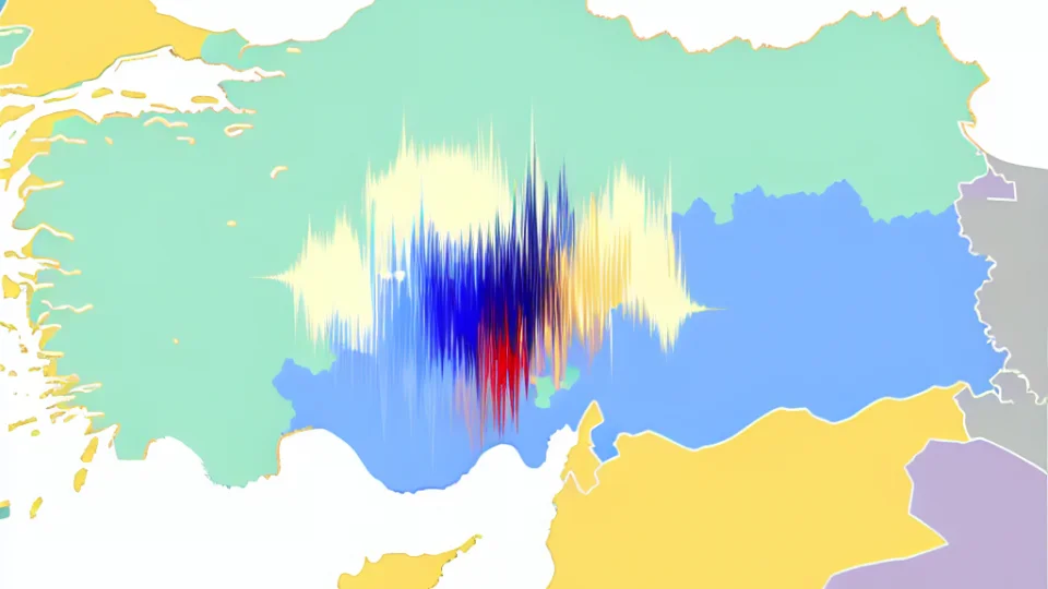
Turkey is a country with a high earthquake risk due to its geographical location. A large part of the country is situated on active fault lines. Particularly, the North Anatolian Fault is one of the most dangerous fault lines affecting the northern part of Turkey. This fault line extends from Istanbul to Eastern Anatolia, and the earthquakes occurring in these regions can cause significant damage. Therefore, it is crucial for people living in these areas to be aware of earthquakes and take necessary precautions.
Another important region is the Eastern Anatolia Region. This area is under the influence of the Eastern Anatolian Fault. This fault line frequently causes high-magnitude earthquakes. Cities like Elazığ and Malatya are among the most affected by these earthquakes. Major earthquakes experienced in the past have led to serious loss of life and property in this region. Therefore, ensuring that buildings in these areas are earthquake-resistant should be one of the local governments' top priorities.
The Marmara Region is another area in Turkey that carries earthquake risk. Istanbul is the largest city in this region and is located right next to the North Anatolian Fault. Experts indicate that a potential major earthquake in Istanbul could have devastating effects. Thus, strict inspections regarding the earthquake safety of buildings in the city are necessary. Additionally, educating the public on how to act before, during, and after an earthquake is of great importance.
Lastly, the Aegean Region is also among the areas at risk of earthquakes. The fault lines in this region frequently generate earthquakes. Particularly, İzmir and its surroundings are notable in this regard. Earthquakes occurring in the Aegean Sea sometimes affect land areas as well. Therefore, it is crucial for residents of the Aegean Region to be informed about earthquake safety and to be prepared. In this context, local governments and NGOs are organizing various training programs.
What is the Relationship Between Fault Lines and Earthquake Magnitude?
Earthquakes are natural events caused by seismic waves occurring on the Earth's surface, and the magnitude of these events is directly related to fault lines. Fault lines are areas where the Earth's crust moves, stretches, or breaks, and the stress that occurs in these areas affects the magnitude of earthquakes. For example, energy accumulated along a fault line can eventually lead to a large earthquake. Therefore, understanding the characteristics of fault lines provides important insights into the magnitude and destructiveness of earthquakes.
Fault lines can be classified into different types, and these classifications influence the magnitude of an earthquake. For instance, normal faults cause earthquakes due to the stretching of the Earth's crust, while reverse faults occur as a result of compression. Each of these different structures affects the amount of energy released during an earthquake and thus its magnitude. In this context, a detailed examination of fault lines is critical for making predictions about potential earthquakes and their magnitudes.
Additionally, the depth and orientation of fault lines are other factors that influence the magnitude of an earthquake. Deep faults may cause less damage compared to those closer to the surface, while surface faults typically lead to greater destruction. Therefore, mapping and analyzing the fault lines in a region is of great importance for risk management and earthquake preparedness. Furthermore, this information provides critical data for engineering applications and the safety of structures.
Finally, the dynamic nature of fault lines deepens our understanding of earthquake magnitudes. When examining past major earthquakes, it has been observed that certain fault lines produce significant earthquakes at specific intervals. This situation provides important data for earthquake predictions and preparedness strategies. Thus, understanding the relationship between fault lines and earthquake magnitude is not only an academic interest but also a vital effort to protect society.
How to Monitor Earthquakes in Real Time?

Real-time earthquake monitoring is one of the most important capabilities offered by modern technology. Earthquakes are natural disasters that occur suddenly, and therefore, providing rapid information flow is vital. Today, earthquake activities can be monitored instantaneously through various sensors and installed stations. These systems determine the moment, location, and magnitude of the earthquake, quickly relaying information to relevant units and the public.
Real-time monitoring systems typically operate using GPS and accelerometer technologies. These devices measure movements on the Earth's surface to detect the tremors that occur during an earthquake. The collected data is immediately aggregated at a central location for analysis. As a result of these analyses, information about the magnitude of the tremor and the affected area can be obtained. Thus, necessary steps for emergency plans and evacuation procedures can be taken swiftly.
Another important feature of earthquake monitoring systems is data sharing. These systems are utilized not only by local authorities but also by international organizations. For example, organizations such as the United States Geological Survey (USGS) and the European Seismological Centre share earthquake data from around the world, helping scientists gain more insights on the subject. This data sharing is of great importance for research and statistics.
In conclusion, the real-time earthquake monitoring system plays a critical role in providing fast and reliable information regarding earthquakes. For these systems to operate effectively, there is a need for continuously updated technologies and trained personnel. Thanks to earthquake monitoring systems, communities become better prepared, while potential damages can be minimized. The development of these systems will be a significant step towards reducing the impacts of future earthquakes.
What Measures Should Be Taken for Earthquake Safety?

Earthquake safety is critically important for ensuring the safety of the areas we live in. The first step in this process is to identify high earthquake risk areas. Structures located on active fault lines can suffer significant damage during an earthquake. Therefore, it is essential to conduct soil studies before constructing buildings and to ensure that the designs comply with earthquake regulations. Additionally, reinforcing existing buildings is another measure that should be considered.
Among the measures individuals should take, teaching proper behaviors during an earthquake is crucial. Drills organized in schools and workplaces help people understand how to act during an earthquake. Furthermore, keeping an earthquake kit at home ensures that essential supplies (water, food, medicine) are readily available in emergencies. Such preparations can be lifesaving in the chaos that may arise after an earthquake.
- Buildings should be constructed in accordance with earthquake regulations
- Soil studies should be conducted
- Reinforcement of existing structures
- Preparation of an emergency kit
Moreover, raising public awareness is also important for earthquake safety. Local authorities can organize seminars to inform the public about earthquakes. Such events help individuals understand earthquake risks and take measures to minimize those risks. Ultimately, creating a societal awareness for earthquake safety will have an impact beyond individual measures. Therefore, everyone needs to be sensitive to this issue.
What is the Impact of Fault Lines on Historical Earthquakes?
Fault lines are points of fracture and slip in the Earth's crust and have a significant impact on historical earthquakes. The stress that accumulates along these lines gradually increases and suddenly releases at a certain point, leading to major earthquakes. For instance, the San Andreas Fault has been associated with frequent earthquakes in California. Earthquakes occurring along this fault line have caused significant damage throughout history, resulting in the loss of thousands of lives.
The impact of fault lines on historical earthquakes is crucial for understanding the seismic activity in the relevant region. Major earthquakes that have occurred in the past on a specific fault line help determine the potential for future earthquakes on that line. Therefore, historical data is collected to study the behavior of fault lines. For example, the 1939 Erzincan earthquake has been recorded as one of the most destructive earthquakes in Turkey, and this event has highlighted the dangers posed by the fault structures in the region.
The effects of fault lines are not limited to major earthquakes; minor tremors can also occur along these lines. These small earthquakes may herald larger ones in the long term. Continuous monitoring of the stress on fault lines can aid in the prediction of potential major earthquakes. Such measures are critically important, especially in areas with high population density.
In conclusion, the impact of fault lines on historical earthquakes is extremely important for seismic research. Without studying these lines, it is impossible to develop earthquake risk management and prevention strategies. Therefore, understanding the relationship between fault lines and historical earthquakes is a vital issue for both scientists and local authorities. Analyses conducted on past earthquakes provide critical data for assessing potential risks in the future.
How Reliable Are Earthquake Predictions?

Although earthquake predictions are a scientifically challenging field, they have started to become more reliable with advancing technology. Generally, it is quite difficult to predict the exact date, location, or magnitude of earthquakes. However, some scientists are trying to identify high-risk periods by analyzing the activity of fault lines in specific regions. The reliability of such predictions is particularly enhanced through the examination of historical data and seismic activities.
Earthquake predictions are mostly made through statistical analyses and mathematical modeling. Scientists attempt to predict potential future earthquakes by studying past earthquakes and utilizing current seismic data. However, these predictions may not be 100% accurate and are often based on general trends. Therefore, predictions are usually made on a regional basis and provide information about periods when the risk may increase within a specific timeframe.
Various projects are being conducted in different countries around the world to predict earthquakes. For example, Japan has developed warning systems by continuously monitoring changes in seismic activity. These systems aim to minimize loss of life and property by alerting people before a potential earthquake occurs. However, the effectiveness of these systems cannot always be guaranteed at 100%, and therefore it is important for citizens to take their own safety precautions.
In conclusion, earthquake predictions are continuously being improved through scientific research. However, the reliability of these predictions has always been a controversial topic. Earthquakes are inherently unpredictable events, and any prediction comes with a certain margin of error. Therefore, being prepared for earthquakes and taking safety measures is the responsibility of every individual.